
Verified Palm Springs ZIP Codes
Only 92262 and 92264 were verified in authoritative city and USPS material as serving Palm Springs addresses. The Palm Springs ZIP code directory should therefore publish what is supported and leave neighborhood splits, population counts, and unverified postal claims out. A postal code describes delivery geography. It does not establish a city boundary, neighborhood membership, voting district, parcel ownership, or land regime.
| ZIP Code | Areas Safely Supported | Post Office | Notes |
|---|---|---|---|
| 92262 | Palm Springs delivery addresses; exact street requires USPS check | Palm Springs Post Office, 333 N Sunrise Way, Palm Springs, CA 92262-9998 | Retail M-F 8-5, Sat 9-3; boxes, general delivery, carrier service, kiosk |
| 92264 | Palm Springs delivery addresses; exact street requires USPS check | Within the Palm Springs postal delivery network | Station assignment depends on the address |
The research did not verify an exhaustive neighborhood assignment between the two postal codes. It also did not establish an active PO-box-only 92263, a ZIP split or realignment year, or per-ZIP population and registration figures. Those limits belong in the Palm Springs postal directory rather than being filled with a map guess.
92262 and the Palm Springs Post Office
ZIP 92262 is tied to Palm Springs delivery addresses in the verified material. The Palm Springs Post Office is listed at 333 N Sunrise Way, Palm Springs, CA 92262-9998. The research records retail hours of Monday through Friday from 8:00 to 5:00 and Saturday from 9:00 to 3:00, plus PO boxes, general delivery, carrier service, and a kiosk.
A mailing address with 92262 can be used as a USPS clue, but the next steps remain exact-address checks. USPS may resolve the delivery label while Riverside GIS determines whether a parcel is inside the city line, in a district, on a reservation overlay, or in another mapped area. The postal code alone cannot answer those questions.
For a family or address search, save the full USPS result and the date checked. Then use the APN and legal description if the question turns to property or a recorded deed.
Why 92264 Needs Address-by-Address Checking
ZIP 92264 is also supported as serving Palm Springs delivery addresses, but the research does not assign every named neighborhood or street to it. The post-office station can depend on the address. That is a useful practical difference from a city map: the same city name can carry delivery routes with distinct ZIP treatment.
Do not turn 92264 into a neighborhood roster. Run the complete street address through the USPS city and state or street lookup, then compare the result with Palm Springs city maps and Riverside GIS. If a name is the actual question, the ZIP narrows geography but does not create a public person search.
This cautious method also protects against a common error in a ZIP code directory: treating a postal label as proof that a parcel is within the same civic, voting, or land jurisdiction.
Finding Palm Springs Residents ZIP by ZIP
A postal code can narrow a records workflow, but the public sources in the research do not provide an anonymous ZIP-wide Palm Springs resident roster. Use the ZIP as one field in a chain, then move to the record keeper that matches the question. Address and parcel work belong with ACR and GIS. A requester’s own voter status belongs with the Secretary of State. Historical names belong with the library and archives.
- Verify the complete delivery address and ZIP through the USPS lookup.
- Use Riverside GIS to compare the address with the Palm Springs boundary, parcel, district, and ZIP layers.
- Run the address through Riverside ACR to obtain an APN and property facts; use the assessor office for permitted ownership-roll inspection.
- For a dated name or household, search a historical directory, phone book, census schedule, or newspaper rather than implying a current ZIP roster.
- Once the ZIP narrows to a street, continue with the Palm Springs by-address record chain.
A ZIP filter is a narrowing aid. It does not change the access rules for a court, vital, voter, deed, or city record.
USPS Fields for a ZIP Check
The USPS city and state lookup is the right place to verify a mailing ZIP before using it in a Palm Springs ZIP code directory search. The research supports a full street-address check, city, and state. The result is delivery evidence, not a resident or parcel result.
| Street address | Enter the complete delivery address, including the street number and name. |
|---|---|
| City | Use Palm Springs as the mailing city supplied for the address. |
| State | Use California to avoid a same-name city match. |
| ZIP result | Record the returned ZIP or ZIP+4 and the date of the check. |
The USPS city and state lookup is the manifest source for Palm Springs ZIP verification.
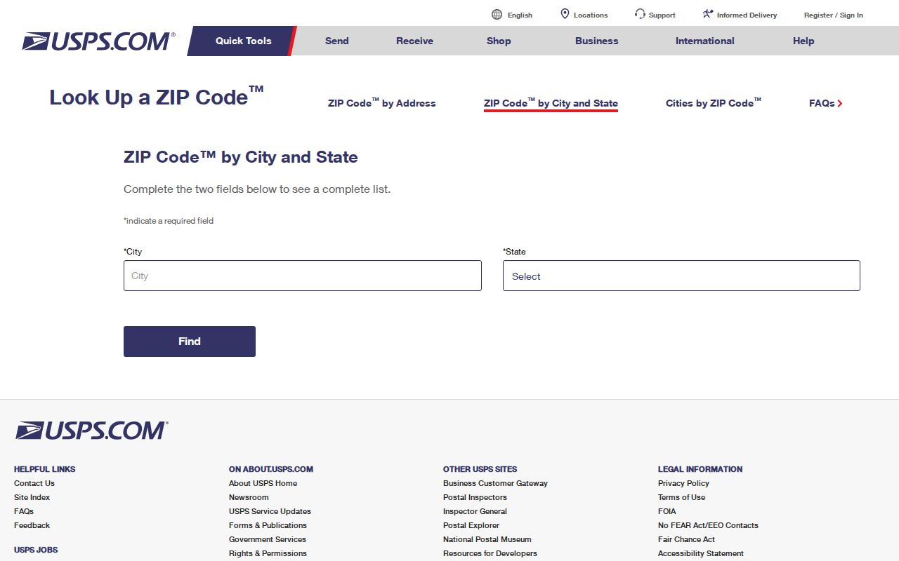
Use the postal result to validate delivery geography before comparing it with city and parcel layers.
- ZIP code
- A five-digit postal delivery area that may cross civic or neighborhood lines.
- ZIP+4
- The extra four digits narrow delivery within a ZIP; they do not identify a household for public use.
- PO-box ZIP
- A ZIP used for post-office boxes or a special delivery arrangement, which needs direct USPS confirmation.
- Carrier route
- A delivery route within the postal system, not a parcel boundary or resident list.
The Riverside GIS ZIP Layer
Riverside Map My County lets a Palm Springs postal-map researcher compare ZIP geography with parcel outlines, address points, city limits, census tracts, districts, spheres of influence, historic and proposed annexations, schools, water districts, zoning, and permits or code cases. Enable the ZIP and boundary layers, identify the parcel, and save the APN. The public parcel layer carries geometry and APN information but no owner field.
The map is especially useful when the postal city and city line seem to disagree. It can show that a delivery label and a municipal overlay are different facts. It cannot determine residency, a mailing recipient, or the legal status of a person. The assessor and recorder remain the custodians for parcel and instrument questions.
Palm Springs ZIP Codes and City Limits
A ZIP code directory should keep postal geography and civic geography in separate columns. The city GIS hub supplies city-boundary, vicinity, council-district, and ONE-PS maps. Riverside’s General Plan discusses a Sphere of Influence, which is unincorporated land that may receive future services or annexation but is not under ordinary city regulatory control.
The 1970 Palm Springs annexation added about 34 square miles of San Jacinto and Santa Rosa Mountains, largely low-density mountain land. That makes the municipal outline much larger than the urban delivery area. A city boundary map may extend into a place with sparse addresses, while the ZIP follows the mail route.
Boundary rule. Verify the postal address with USPS, the municipal overlay with Palm Springs maps, and the parcel with Riverside GIS and ACR. No single ZIP result supplies all three.
The 1970 Mountain Annexation Changes the Map
The 1970 annexation is a local geography story that matters to address research. A Palm Springs postal code may point to delivery geography while the city’s legal outline includes mountain land that is not part of the dense street grid. The result is a mismatch that can make a broad map look like a complete directory even when only a few exact addresses are serviceable.
Use the annexation fact as a reason to inspect the layer, not as a reason to assign a person or household to a ZIP. When the address is on a parcel affected by a boundary, keep the USPS result, city map, county APN, and land-status overlay as separate evidence.
Agua Caliente Checkerboard Geography
Agua Caliente Reservation geography is the defining Palm Springs parcel quirk. Even-numbered sections include Tribal Trust, Allotted Trust, and fee land. A delivery address can therefore share a city and ZIP with another address while the land records and responsible institutions differ. A postal directory that ignores this layer can send a property researcher to the wrong custodian.
For land or family-history work, use USPS for delivery, city maps for civic geography, Riverside GIS for parcel overlays, ACR for APN and recorded instruments, and tribal, federal, or Bureau of Indian Affairs sources when the land status calls for them. Postal sameness does not mean records sameness.
Three Keys for a Palm Springs ZIP
Three keys keep a ZIP code directory search from drifting. Situs tells where the physical parcel is. Mailing address tells where owner correspondence goes. Legal description and APN identify the land in assessor and recorder systems. A ZIP belongs to the delivery label, not automatically to all three keys.
| Key | Custodian or Tool | Use | Do Not Infer |
|---|---|---|---|
| Delivery address and ZIP | USPS | Validate the mailing label | City limits or occupants |
| Situs and APN | Riverside ACR and GIS | Locate parcel and property facts | Every resident |
| Legal description | Recorder and assessor | Match older land instruments | Move-in date or household |
Once the ZIP is only a starting filter, the address-level method can take over. Do not publish a ZIP split that the research did not verify.
Unverified ZIP Claims Stay Unverified
The research did not locate an authoritative street-by-street assignment of Palm Springs neighborhoods between 92262 and 92264, a confirmed active PO-box-only 92263, a ZIP realignment year, or per-ZIP population totals. That is not a weakness to hide. It tells a reader to use the exact USPS lookup and to save the result.
For organized neighborhood context, the city’s inventory of 52 recognized neighborhood organizations and the ONE-PS guide are separate civic and history sources. They do not turn a neighborhood name into a ZIP roster. Keep postal, parcel, civic, and historical evidence distinct when the ZIP code directory is used for a person or address question.